‌‌‌‌​​‌‌​‍‌​‌​‌‌‍‍‌​‍‌‌​​‌​​‌‌​‍OmniViewThe world, in view

Just for fun · Live · Free to explore

The whole world, live. Click anything.

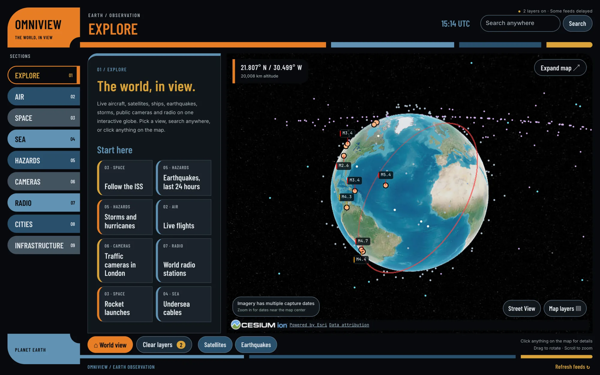
OmniView puts live aircraft, satellites, earthquakes, storms, ships, public traffic cameras and world radio on one interactive 3D globe. Click anything on it and you get the details — what it is, where the data came from, and how fresh it is.

Free, in your browser — no account, nothing to install Built on public data, with every source credited Just for fun — there’s nothing to buy
OmniView — Explore
OmniView's Explore screen: the LCARS-style section rail and briefing beside a live 3D globe showing satellites and the day's earthquakes
  • 9sections to explore
  • 24 hrsof USGS earthquakes
  • 30 daysof rocket launches
  • 7,740public traffic cameras
  • $0to explore all of it
How it works

Pick a section. Search anywhere. Click anything.

No manual required — it’s a globe. But here’s the quick tour.

01

Pick a section

Nine sections run down the side — Explore, Air, Space, Sea, Hazards, Cameras, Radio, Cities and Infrastructure. Each one switches on its own live layers.

02

Search anywhere

Type a city, a landmark or a pair of coordinates and fly straight there. Or search inside a section: flights by callsign, ships by name, satellites by name or NORAD number.

03

Click anything

Planes, satellites, quakes, storms, cameras, radio stations, cables — each one opens a details card that names its source and says how fresh it is.

04

Follow along

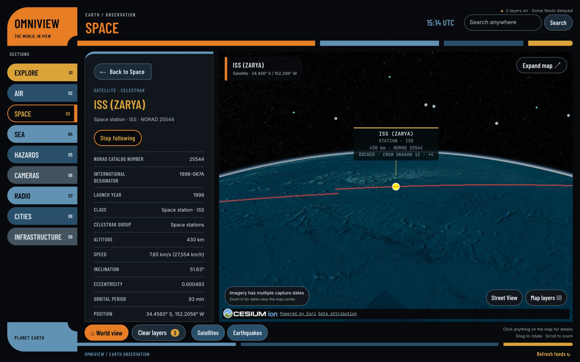
Fly to it, follow the International Space Station around the planet, or ride behind a tracked aircraft in cockpit view.

What’s on the globe

Nine sections. One restless planet.

Each section is a different way of looking at the same live Earth. Pick one to open it in OmniView.

Explore01

The front door: eight one-click starting points, from following the ISS to the last 24 hours of earthquakes, London’s traffic cameras and world radio.

Open Explore

Air02

Aircraft positions from public ADS-B feeds, military flights picked out in amber, and a “Find a flight near here” button that follows the closest one to the middle of your map.

Open Air

Space03

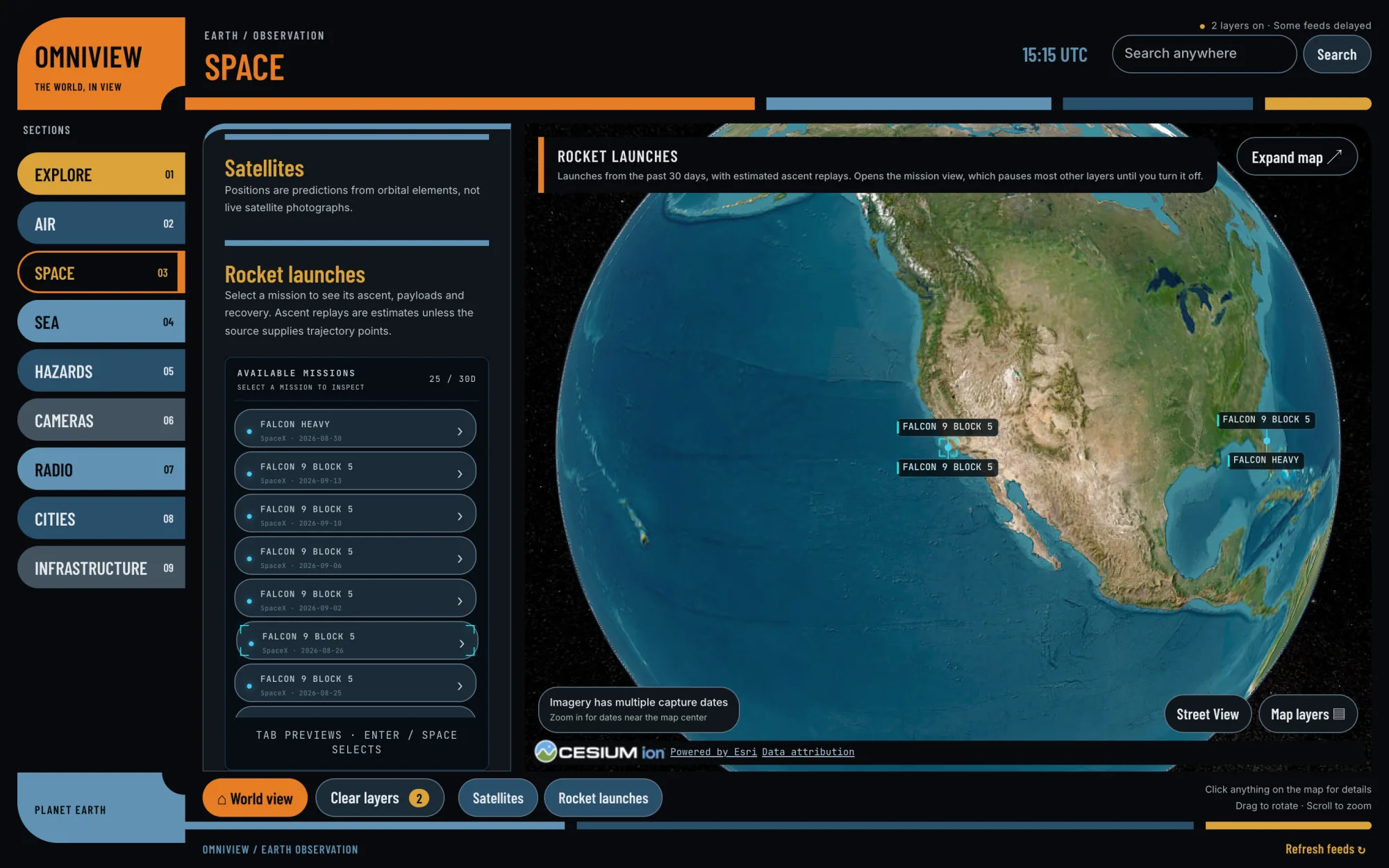
Satellites plotted from published orbital elements, the ISS on follow, and the past 30 days of rocket launches with their ascents replayed as clearly labelled estimates.

Open Space

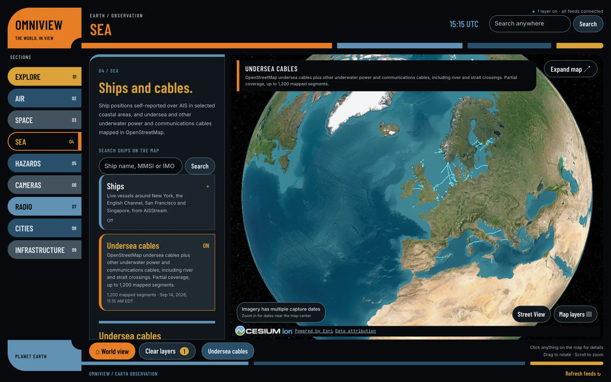
Sea04

Ships reporting their own positions over AIS around New York, the English Channel, San Francisco and Singapore — plus undersea cables mapped in OpenStreetMap.

Open Sea

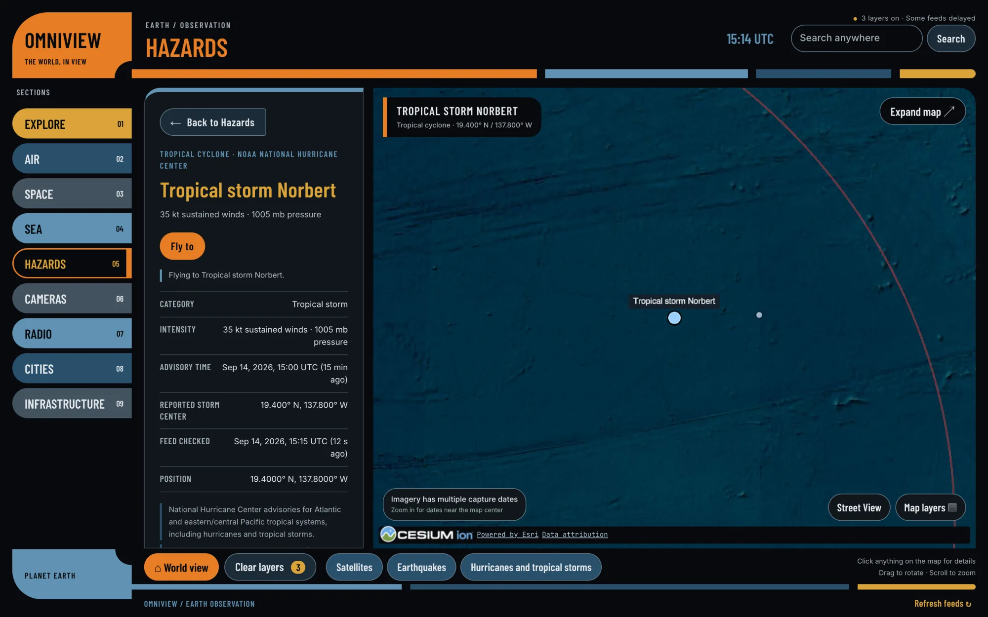
Hazards05

USGS earthquakes, tropical storms from the National Hurricane Center, US tornado warnings, and NASA reports of wildfires and volcanic activity.

Open Hazards

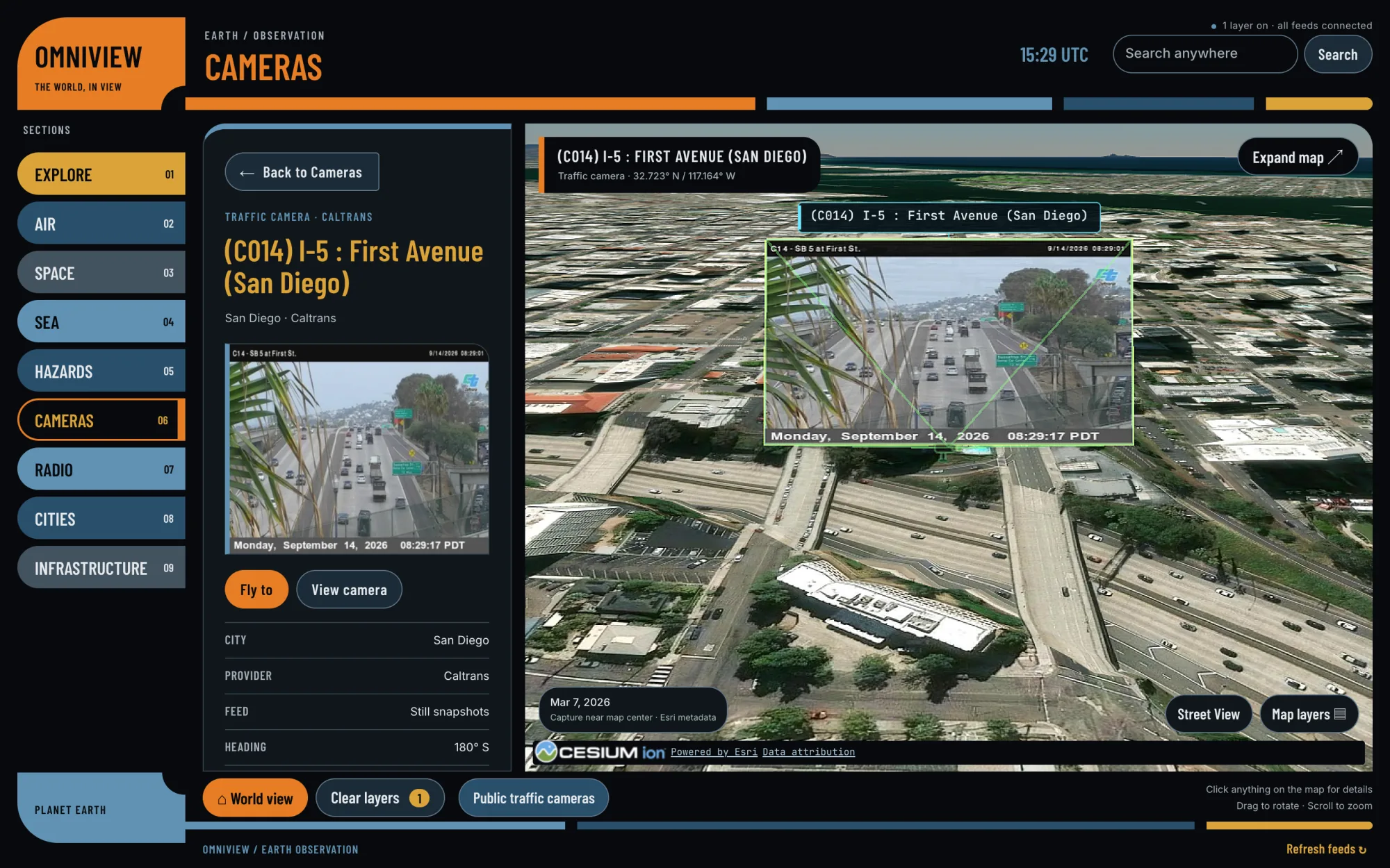
Cameras06

7,740 public traffic and road cameras across the US, Europe and Hong Kong. Search a place to fly there and find the nearest connected cameras, each with its latest still frame.

Open Cameras

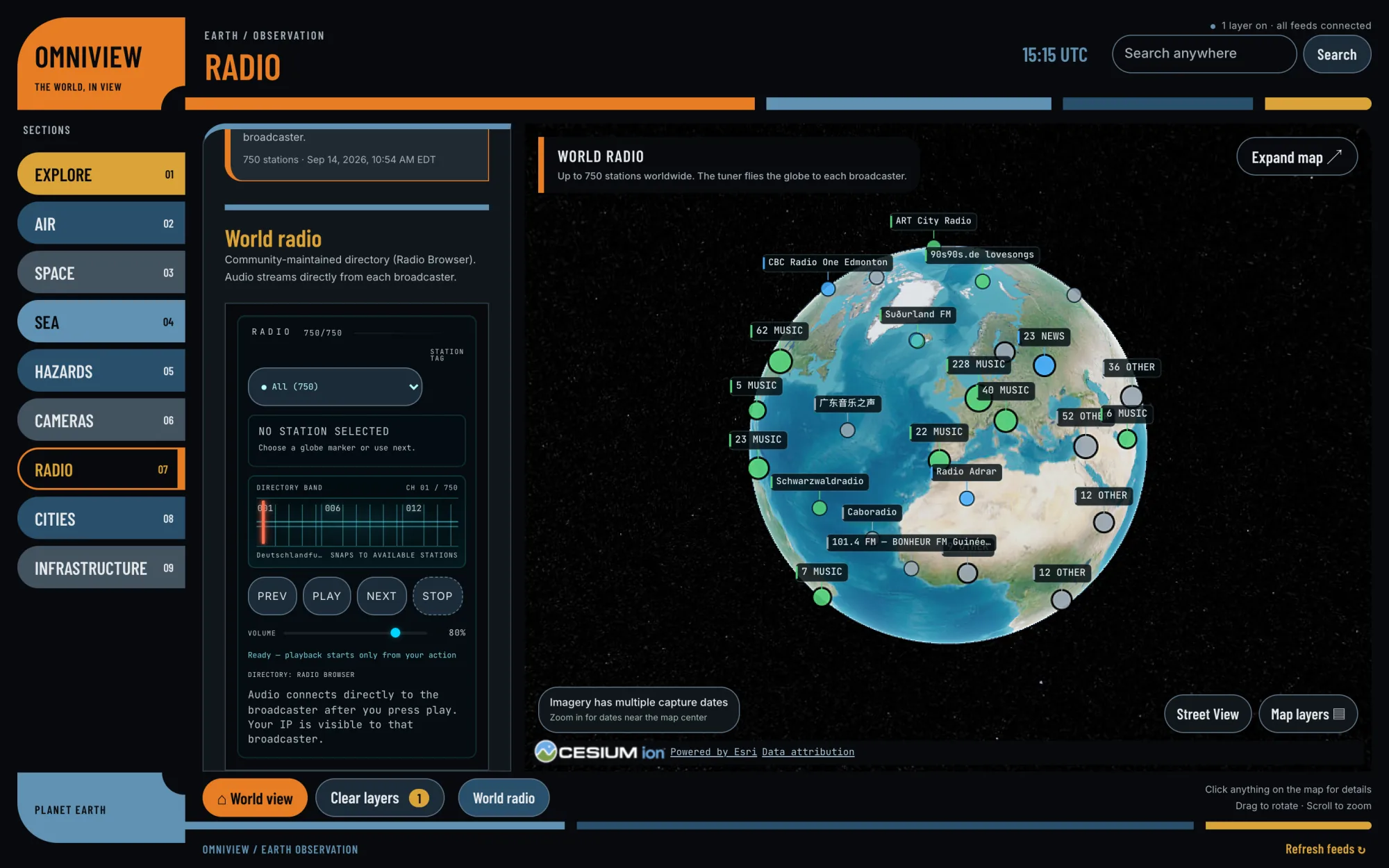
Radio07

Up to 750 stations, pinned to where they broadcast from. Drag the tuner and the globe flies to whoever’s on the air.

Open Radio

Cities08

Bikeshare stations with live availability in supported cities, and simulated traffic moving along real roads.

Open Cities

Infrastructure09

The built world: datacenters, dams and military installations, as mapped by OpenStreetMap’s volunteers.

Open Infrastructure
Click anything

Every dot has a story.

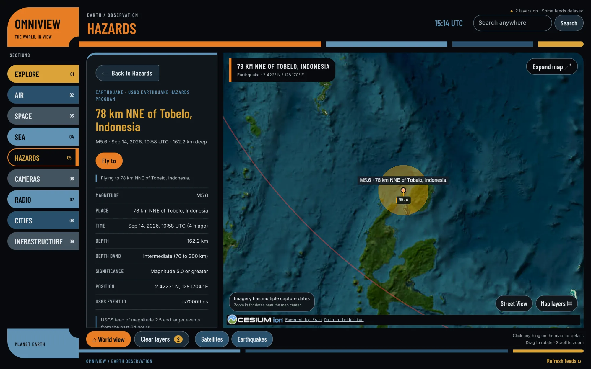
Click an earthquake and you get its magnitude, depth and time, straight from the USGS. Click a traffic camera for its latest frame and which way it’s pointing, or a satellite for its orbit. Every card names its source and says how fresh the data is — and live items keep updating while you watch.

  • Details on everything, with proper units
  • A source and an “updated” time on every card
  • Fly to it, follow it, or open the original source

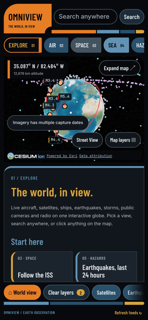
On a phone, the map sits above a scrolling briefing. (A big screen is more fun.)

OmniView details card for an earthquake, with its magnitude, depth, time and USGS source beside the map
OmniView on a phone: the globe above the scrolling Explore briefing
See it in action

Real screens. Live data.

Captured from the live site on 14 September 2026 — whatever the planet happened to be doing at the time. Click any screen to enlarge.

// live captures from omniview.wandzilakwebdesign.com — your visit will look different, because the world moved

Pricing (sort of)

One plan. It’s the whole planet.

Every other app on this site has a pricing section, so OmniView gets one too.

The only plan
The Planet Plan
$0 / planet
no card · no account · no catch

Everything OmniView does, for anyone with a web browser.

  • One Earth, fully loaded
  • All nine sections included
  • Follow the ISS as often as you like
  • Up to 750 radio stations on the dial
  • Unlimited clicking
Launch OmniView

OmniView is a just-for-fun project. There’s nothing to buy, nothing to upgrade, and no sales call waiting at the end of it.

Honest about the data

Fun to use. Serious about sources.

It looks like a spy-movie control room. It runs entirely on public data — and it tells you exactly whose.

📡

Public sources, credited

Aircraft from ADSB.lol, satellites from CelesTrak, earthquakes from the USGS, storms from NOAA, wildfire and volcano reports from NASA, cameras from nine networks across the US, Europe and Hong Kong. The credits stay on the map.

⏱️

Live, delayed or estimated

Satellite positions are calculated from orbital elements. Launch ascents are reconstructions. Street traffic is simulated on real roads. When a free feed drops out, OmniView says so instead of faking it.

🛰️

Things, not people

It maps aircraft, ships, satellites, storms, cameras and cables. There’s no person search and no face recognition.

🧭

For exploring, not navigating

It’s a window on the world, not an instrument. Don’t fly, sail or make safety decisions with it — go to the official sources it links to.

Roll credits

Standing on some very tall shoulders.

Based on

God’s Eye View

OmniView is based on God’s Eye View by Bilawal Sidhu, an open-source 3D globe of live public data, released under the MIT License. We took it somewhere new: a public site, nine plain-English sections, search boxes that work, and a details card for everything on the map.

God’s Eye View on GitHub

Inspired by

LCARS

The rounded elbows, colour-coded bars and tall condensed type are our homage to LCARS, the computer interface aboard the Enterprise in Star Trek: The Next Generation. Same spirit, more earthquakes — and every button does something useful.

Data & tools

ADSB.lol · CelesTrak · USGS · NOAA National Hurricane Center · National Weather Service · NASA EONET · AISStream · The Space Devs (Launch Library 2) · Radio Browser · City of Austin · Caltrans · Transport for London · GBFS bikeshare operators · TomTom · OpenStreetMap contributors · Esri World Imagery · Re:Earth terrain · CesiumJS

OmniView is an unofficial fan project. It isn’t affiliated with or endorsed by the makers of Star Trek or by the God’s Eye View project, and every data source keeps its own terms.

Common questions

Things people ask.

Is it really free?
Yes. OmniView runs in your browser at omniview.wandzilakwebdesign.com — no account, no download, nothing to buy. It’s a just-for-fun project.
Can I see cloud cover?
Yes. Turn on Live clouds in Map layers for infrared satellite imagery from NOAA GOES and JMA Himawari, via NASA GIBS. It covers the Americas, Pacific, East Asia and Australia; Europe, Africa and the Indian Ocean are not covered. The image time is shown on screen, and the overlay checks for updates every five minutes.
Is the data really live?
Mostly. Aircraft, ships, earthquakes, storms and camera frames come from live public feeds, refreshed on cycles from under a minute to a few minutes. Satellite positions are calculated from published orbital elements, rocket ascents are reconstructions, and street traffic is simulated. Each details card tells you which is which.
Why are there sometimes no planes?
Flight positions come from a free, community-run ADS-B feed that limits how often it can be asked. When it’s busy, OmniView tells you the feed is delayed rather than passing old positions off as live.
Can I use it to navigate, or to track someone?
No and no. It’s an exploratory visualization — never use it for flight, maritime or emergency decisions. And it maps things, not people: there’s no person search and no face recognition.
What’s God’s Eye View?
An open-source 3D globe of live public data created by Bilawal Sidhu and released under the MIT License. OmniView is built on it, and the credit appears on OmniView’s own loading screen as well as on this page.
What’s LCARS?
LCARS — the Library Computer Access/Retrieval System — is the look of the Enterprise’s computer screens in Star Trek: The Next Generation: rounded elbows, colour-coded bars and tall condensed type. OmniView’s interface is a fan homage to it.
Does it work on my phone?
Yes. On a phone the map sits above a scrolling briefing. It needs a browser with WebGL, which almost every modern one has — but a laptop or a big screen is more fun.
Could you build something like this for us?
If your business has live data that belongs on a map — vehicles, locations, sensors, service areas — we’d love to hear about it. Start a conversation.
Just for fun

Go poke at the planet.

It’s live right now. The ISS laps the Earth about every hour and a half — go see where it is this minute.